7. Section Geoinformatics and Spatial Data Modeling
- Advanced Geospatial Modeling Techniques
- Computational Methods for Spatial Data Analysis
- Machine Learning and AI in Spatial Data Modeling (New)
- Data Integration for Earth Sciences and Environmental Monitoring
- Cloud Computing and Big Data for Geospatial Applications (New)
- Decision Support Systems for Resource and Environmental Management
- Real-Time Spatial Data Processing and Analysis (New)
- Spatial Data Infrastructure for Sustainable Development
- Geostatistics and Spatial Uncertainty in Earth Sciences (New)
- Visualization and Simulation of Geospatial Data (New)
8. Section Geodesy, Surveying, and Spatial Infrastructure
- Global Geodetic Networks and Spatial Infrastructure Development
- Precision Geodesy for Earth Observation and Monitoring
- Satellite Geodesy and Global Positioning Systems (GPS)
- Techniques for High-Precision Land Surveying
- Remote Sensing Integration in Surveying and Mapping (New)
- Geometric Properties of the Earth and Tectonic Movements
- Geodesy in Climate Change Monitoring and Mitigation (New)
- Spatial Infrastructure for Urban and Environmental Planning
- LIDAR and Photogrammetric Techniques in Geodetic Surveying (New)
- Engineering Geodesy for Infrastructure Monitoring (New)
9. Section Photogrammetry, Remote Sensing, and Earth Observation
- Advanced Photogrammetry for High-Resolution Earth Imaging
- Multi-Spectral and Hyperspectral Imaging Technologies (New)
- Synthetic Aperture Radar (SAR) in Earth Observation
- Remote Sensing for Environmental and Climate Change Monitoring
- UAVs and Drones for Earth Observation and Mapping (New)
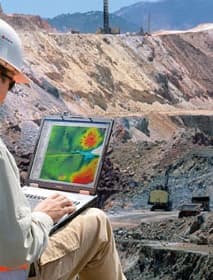
- Applications of Remote Sensing in Disaster Monitoring and Risk Reduction
- Remote Sensing in Land Use and Natural Resource Management
- Machine Learning in Remote Sensing Data Processing (New)
- Satellite-Based Remote Sensing for Urban Development
- Earth Observation for Ecosystem and Biodiversity Monitoring (New)
10. Section Cartography, GIS, and Artificial Intelligence (AI)
- Advances in Digital Cartography and Visualization Techniques
- Geographic Information Systems (GIS) for Environmental Planning
- Artificial Intelligence in Geospatial Data Analysis
- Automated Mapping and Data Visualization with AI (New)
- GIS and Remote Sensing Integration for Resource Management
- 3D and 4D Cartographic Modeling and Visualization (New)
- Applications of GIS in Disaster Risk Management and Mitigation
- AI-Powered Spatial Data Processing and Prediction Models (New)
- GIS for Urban Planning and Smart Cities Development
- Cartographic Innovations for Sustainable Development Goals (New)